The Everyday Geography Hidden in Street Names
A cultural geography guide to reading street names as clues to old roads, vanished work, development themes, public memory, and local maps.
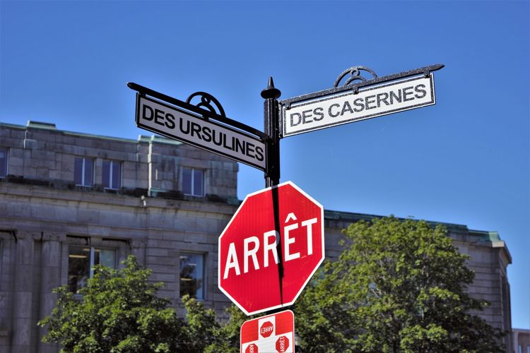
Start with the object, habit or tradition, then follow the context that makes it interesting.
The Everyday Geography Hidden in Street Names
Street names look like background text until you start reading them as a local archive. A road may preserve the name of a farm, a vanished industry, a field feature, a political figure, a builder, a battle, a tree line, or a marketing idea from a housing developer. The names are not always noble, accurate, or complete. They are clues to how a place wanted to remember itself at the moment a map was made.
This article is a cultural and historical explainer, not a definitive local history. Street naming rules vary by country, council, municipality, and private development. For readers who want to explore place names more formally, the U.S. Geological Survey maintains the <a href=“https://www.usgs.gov/us-board-on-geographic-names”>U.S. Board on Geographic Names</a>, and UK readers can compare local naming processes through council planning pages and national archives.
Start with the oldest road in the area
Older roads often follow practical routes: high ground, river crossings, market paths, railway approaches, parish boundaries, or routes between farms. Names such as Mill Road, Church Lane, Station Road, River Street, Quarry Lane, or Market Square are often literal, though the original mill, church, station, river trade, or quarry may have changed or disappeared.
Look at whether the road curves while newer streets form a grid. Curves can show older paths absorbed into modern development. A straight estate road may be a planning decision; a winding lane may remember feet, carts, animals, water, or property lines.
Names can preserve vanished work
Industrial and trade names are especially revealing. Foundry Street, Tannery Lane, Dock Road, Weaver Close, Brickfield Avenue, Brewery Yard, and Ropewalk may point to jobs that once shaped the neighborhood. Even when the buildings are gone, the name can keep the old economy visible.
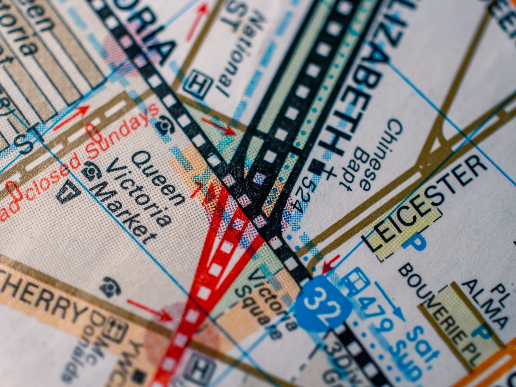
A local history archive, historic map, or city directory can test the clue. The <a href=“https://www.loc.gov/maps/”>Library of Congress map collections</a> and national or municipal map archives are good examples of how maps can preserve earlier land use. In Europe, local cadastral maps and planning records often play a similar role.
The short walk test
Choose three nearby streets and ask four questions:
- Does the name describe a feature, person, job, plant, place, event, or aspiration?
- Does the street shape look older or newer than the surrounding grid?
- Are nearby names part of a theme, such as trees, poets, rivers, aircraft, or local families?
- Does the name match what you can still see, or does it point to something missing?
This short walk turns ordinary signs into a reading exercise. It also shows how quickly places layer different eras on top of each other.
Developer themes tell a different story
New housing areas often use themed naming groups: birds, trees, writers, inventors, local villages, maritime words, or pastoral terms. These themes make a development feel coherent and marketable. They can also create a sense of countryside even on land that was recently industrial, suburban, or agricultural.
Names such as Meadow View, Orchard Close, or Willow Park may describe a real field. They may also describe the feeling the development wants to sell. Neither case is automatically bad, but the difference matters. A name can reveal aspiration as much as history.
People’s names are never neutral
Streets named after people reflect choices about honor, power, memory, and politics. Some commemorate local benefactors, activists, artists, scientists, soldiers, landowners, or officials. Others preserve names now debated because the person’s actions look different through modern ethical standards.
When a street is renamed, the debate is often about more than a sign. It asks who gets remembered, who was ignored, and whether public space should keep honoring a particular figure. Different democracies handle this through councils, public consultation, heritage boards, or national rules.
Numbering can reveal growth
Street numbers also tell stories. Odd and even sides may show a planned numbering system. Missing numbers may reveal demolished buildings, combined lots, or superstition around certain numbers. A sudden jump in numbers can show where a road was extended or where rural addressing met urban growth.
In some places, house names predate numbers. In others, emergency services and postal systems pushed more standardized addressing. What looks like administrative detail is part of how a settlement became easier to govern, deliver to, and navigate.
Common mistake: assuming the name is the full truth
A street called Roman Road may follow a Roman route, or it may simply be near one, or it may be a later romantic label. A lane named after a family may reflect land ownership rather than public affection. A nature-themed street may stand where the named plant never grew.
Treat the sign as a clue, not a conclusion. Compare it with maps, archives, local museums, newspapers, and oral history. The fun is in the investigation, not in making the quickest claim.
Why duplicate names happen
Large cities and merged towns sometimes have repeated names because separate settlements once named roads independently. When boundaries changed, the names collided. Postal codes, ZIP codes, districts, and numbering systems then became important for avoiding confusion.
Renaming every duplicate can be disruptive because addresses are tied to identity documents, businesses, maps, memories, and legal records. That is why apparently messy systems often persist. Administrative convenience has to compete with local continuity.
A small source note for local research
Good local street-name research usually combines several sources: historic maps, property records, council minutes, local newspapers, planning applications, business directories, and community history projects. A single blog post may be useful, but it should not carry the whole story if you are writing something formal.
For casual curiosity, start with a map archive and a walk. For publication, verify with primary or local institutional sources where possible.
Street names are public memory in small type
The signs at corners and junctions are easy to ignore because they are functional. They help taxis, deliveries, emergency services, visitors, and residents. But they also hold fragments of work, land, power, fashion, and memory. A familiar route can become more interesting once its names are read as evidence.
The next time you pass a street sign, ask what had to exist for that name to make sense. Sometimes the answer is still visible. Sometimes the name is the only remaining landmark.
Natural has can survive only as names
Street names often remember streams that were culverted, woods that were cleared, commons that were enclosed, fields that became housing, or hills softened by road engineering. Brook Street, Marsh Lane, Orchard Road, and Windmill Hill may be more than picturesque labels. They can point to older environmental has that shaped settlement before modern drainage, transport, and planning changed the surface.
This can matter for more than curiosity. Low-lying names, old watercourse names, and former marsh references sometimes align with flood history or soil conditions, though a name alone is never proof. It is a prompt to check maps, local environmental records, and planning documents.
Pronunciation is part of the archive
Local pronunciation can preserve history that spelling hides. A street named after a family, estate, saint, or older language may be pronounced in a way newcomers do not expect. Those pronunciations travel through speech, schools, buses, shops, and local jokes. They are fragile because they can fade when populations change or when navigation apps flatten everything into a standard voice.
Asking longtime residents how a name is said can reveal as much as reading the sign. It also keeps street-name research from becoming only a map exercise. Places are spoken as well as written.
Political boundaries leave quiet traces
Boundary Road, County Line, Tollgate, Customs Street, and similar names can point to former administrative edges. Even when borders move, the name may remain. These names are useful because they show that geography is not only rivers and hills. It is also taxation, policing, parishes, postal routes, school catchments, and municipal power.
A street near an old boundary may have buildings from different periods on each side because land was governed or developed differently. That pattern is not guaranteed, but it is worth checking on old maps. Names invite questions about who had authority over a place and when.
Transport names show changing movement
Station Road, Tramway Street, Turnpike Lane, Canal Walk, Ferry Road, and Airport Way are movement fossils. Some still point to active transport. Others remember infrastructure that disappeared or shifted. A road named for a ferry can remain long after a bridge changed how people cross.
Transport names are especially good for understanding why shops, pubs, warehouses, and housing gathered where they did. Movement creates business, and business leaves names behind.
Commemorative waves show what a society admired
Some neighborhoods reveal naming fashions from a particular decade. One area may honor astronauts, another war memorials, another poets, another local councillors, another trees. These waves show what developers, officials, or residents thought would create pride, order, or appeal at the time. A cluster of names is often more revealing than one street alone.
Look for whether the theme includes women, minority communities, workers, Indigenous names, local languages, or only powerful men. Absence is information too. Street names can show who was visible in public memory and who had to be recovered later through plaques, renaming campaigns, or community history.
Maps and names can disagree
A modern navigation app may standardize a name that local people shorten, translate, or ignore. A paper map may preserve an older spelling. A road sign may contain a typo that became permanent. In multilingual regions, official names and everyday names may coexist.
This is why street-name research benefits from more than one source. The map tells one story, the sign another, and local speech a third. The interesting question is not always which one is correct, but why several versions exist.